 Montenegro
About the country
Montenegro
About the country
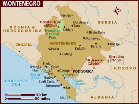
Montenegro is a country located in Southeastern Europe. In Croatian the name of the country is Crna Gora and in Serbian it is Црна Гора both meaning “Black Mountain”. “Montenegro” is an Italianized name for the country. Its official name is Republic of Montenegro. The country has a coast on the Adriatic Sea. It is bordered by Croatia to the south-west, Bosnia and Herzegovina to the northwest, Serbia to the east and Albania to the southeast. Up to the middle of the year 2006 the country had been a part of the Confederate State Union of Serbia and Montenegro (Smaller Yugoslavia) but on 3 June 2006 it declared its independence.
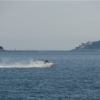
Montenegro is renowned for its stunning array of natural wealth, diverse scenic beauty, splendid sea and sandy beaches. One of the legends tells that the country got its name due to the numerous olive trees covering the mountains the bark of which is of the black color.
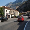
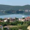
Montenegro geography ranges from high peaks to deep canyons, warm sea to cold lakes, rapid rivers to peaceful areas of outstanding natural beauty. The territory of the country consists of the three diverse landscape zones. The beachside terrain that is 10 kilometers wide lines along the Adriatic Sea from Herceg Novi (in the west) to the Bojana river (in the east). Next there is a mountain chain that opens to the Skadar Lake, Zeta river valley, Bjelopavlic plain and Nikšić field.
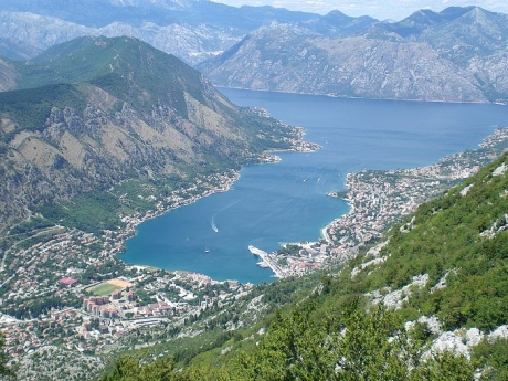
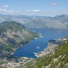
Despite the fact that Montenegro is a small country it is known to have the outstanding amount of the world’s greatest geographical sights. These are: The Bay of Kotor that occupied 40 kilometers of the land and is the southernmost fjord of the Northern hemisphere; Tara River Canyon which is the deepest canyon in Europe; Montenegrin Adriatic coast which is the most nature friendly area in the Mediterranean world; 48 mountain peaks that are more than 2000 high above sea level.
Montenegro is a country of the ice caves and splendid abundant waterfalls that are numerous in the Prokletije Mountains. It is also a country of the cold mountain lakes such as The Lake Biograd, The Cherny Lake, The Vizietorsky lake (over 40 beautiful lakes). The lake areas are inhabited by deer, roe deer, wild boars and bears.
 Croatia
 Slovenia
 Albania